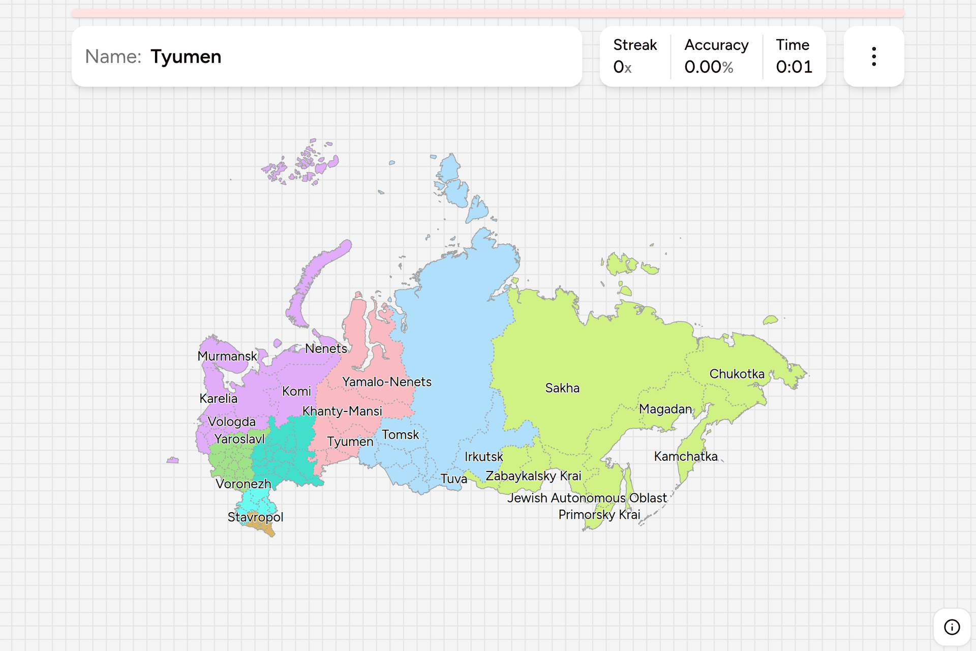
Russia is a federation, and the parts it is a federation of are not all the
same kind of thing: republics with their own languages, oblasts named after a city,
territories called krais, autonomous okrugs inside other regions, and two
cities that are regions in their own right. The name of one is written on the
boundary sign of every road that crosses into it, and on the licence plate of
most of the cars driving out. This page is the whole set, grouped the way the
country groups them, and the game asks you to put each name where it belongs.
- The quiz
- Name to place, on the map
- Names
- English or Russian
- In the game
- 83 federal subjects
What you are looking at
The collective word is federal subject, in Russian subyekt federatsii, and
every one of them sits at the same level of government whatever it is called.
The label attached to a name tells you its history rather than its powers:
- Oblast (область), an ordinary region named after its capital. There are
46, and they are most of the map west of the Urals. Tver Oblast is the
region around the city of Tver, and the two share the name.
- Republic (республика), a region built around a titular non-Russian
people, with the right to a second official language. There are 21, from
Karelia on the Finnish border to Sakha, which is a fifth of the country on
its own.
- Krai (край), a territory. Nine of them, and the word is a historical
leftover: a krai is administered exactly like an oblast.
- Autonomous okrug (автономный округ), four districts of the far north,
three of which sit inside another region as well as being one.
- Autonomous oblast, of which there is exactly one, in the Far East.
- Federal city (город федерального значения), Moscow and St Petersburg,
each a region and a city at once, and each a hole in the oblast named after
it.
Above the subjects, and not a layer of government so much as a way of
organizing the ones below, sit the eight federal districts. They are what this
game groups by, and they are the frame Russians themselves use when talking
about the country at that scale.
The names are worth learning in Cyrillic as well as in English, because
Cyrillic is what the boundary sign says. Turn on the local name in the start
dialog and Tver becomes Тверская область, Tatarstan becomes Республика
Татарстан, and Krasnodar becomes Краснодарский край. Three word endings do
most of the work of reading one: -ская область is an oblast, -ский
край is a krai, and Республика in front of a name is a republic.
How to place one
- Split the country in four before anything else. Everything west of the
Urals and south of the Arctic is the crowded part, and about two thirds of
the subjects are in it. The Urals themselves are a north to south strip of
six. Siberia and the Far East are a dozen enormous regions, most of them
bigger than any country in Europe. The Arctic coast is a row of thinly
populated giants that reach a long way south.
- Then take the giants, because they are free. Sakha covers the northeast
quarter and is the largest subdivision of any country on earth. Krasnoyarsk
Krai is the strip down the middle of Siberia, running from the Sayan
mountains to the Arctic Ocean. Between Sakha and the Pacific are Chukotka in
the far northeast, Kamchatka on its peninsula, Magadan above the Sea of
Okhotsk and Khabarovsk Krai down the coast.
- Then the edges of the crowd. St Petersburg and Leningrad Oblast are the
northwest corner, Kaliningrad is the piece detached on the Baltic, Murmansk
is the one above the Arctic Circle next to Finland, and the Caucasus is the
cluster of small republics squeezed between the Black Sea and the Caspian.
- What is left is the Central and Volga districts, which is where the map
is genuinely hard: two dozen oblasts of similar size and shape around Moscow
and along the Volga, most of them named after a city you would have to know
already.
The traps are almost all names rather than shapes. Novgorod is in the
northwest and Nizhny Novgorod is 900km east of it on the Volga, and they are
different places. Rostov Oblast is on the Sea of Azov, while the town of
Rostov the Great is in Yaroslavl Oblast. There are two Altais side by side in
southern Siberia, the Altai Republic in the mountains and Altai Krai on the
plain to the northwest. Ossetia, Ingushetia, Chechnya and Dagestan run west to
east along the Caucasus in that order, and the first three are small enough
that the order is the only thing that will save you.
Chukotka crosses the antimeridian, so the far northeast of the map is drawn
past 180 degrees east rather than wrapped round to the other side of the
world. It is a real region in its real place, not an inset.
Every federal subject, by district
- Central18 subjects
- Belgorod, Bryansk, Ivanovo, Kaluga, Kostroma, Kursk, Lipetsk, Moscow, Moscow Oblast, Oryol, Ryazan, Smolensk, Tambov, Tula, Tver, Vladimir, Voronezh, Yaroslavl
- Northwestern11 subjects
- Arkhangelsk, Kaliningrad, Karelia, Komi, Leningrad Oblast, Murmansk, Nenets, Novgorod, Pskov, St Petersburg, Vologda
- Southern6 subjects
- Adygea, Astrakhan, Kalmykia, Krasnodar, Rostov, Volgograd
- North Caucasian7 subjects
- Chechnya, Dagestan, Ingushetia, Kabardino-Balkaria, Karachay-Cherkessia, North Ossetia, Stavropol
- Volga14 subjects
- Bashkortostan, Chuvashia, Kirov, Mari El, Mordovia, Nizhny Novgorod, Orenburg, Penza, Perm, Samara, Saratov, Tatarstan, Udmurtia, Ulyanovsk
- Ural6 subjects
- Chelyabinsk, Khanty-Mansi, Kurgan, Sverdlovsk, Tyumen, Yamalo-Nenets
- Siberian10 subjects
- Altai Krai, Altai Republic, Irkutsk, Kemerovo, Khakassia, Krasnoyarsk, Novosibirsk, Omsk, Tomsk, Tuva
- Far Eastern11 subjects
- Amur, Buryatia, Chukotka, Jewish Autonomous Oblast, Kamchatka, Khabarovsk, Magadan, Primorsky Krai, Sakha, Sakhalin, Zabaykalsky Krai
Those are the eight federal districts, and they can be switched on and off
individually in the game's start dialog, which makes the Ural district a short
drill and the Central one a real sitting. One recent change is worth knowing:
Buryatia and Zabaykalsky Krai moved from the Siberian district to the Far
Eastern one in 2018, which is why the Far Eastern district now reaches all the
way to Lake Baikal.
Worked examples
SakhaThe big oneThree million square kilometres, a fifth of Russia, and larger than any
other first level division anywhere. It fills the northeast: the Lena runs
through it to the Arctic, Yakutsk is its capital, and it is the coldest
inhabited place on the planet. If a Siberian region on the map looks too big
to be one region, this is it.
KaliningradThe detached oneThe exclave on the Baltic between Poland and Lithuania, with no land border
with the rest of the country. It was the northern half of East Prussia until
1945 and the city was Königsberg, which is why it looks nothing like the
rest of Russia from the road and why it is the easiest region in the game to
recognize in a photograph.
Moscow OblastThe ringThe oblast that surrounds the capital without including it. Moscow is a
federal subject of its own and a hole in this one, so a click meant for the
oblast has to land outside the ring road and a click meant for the city has
to land inside it. On this map the city is about two pixels across with the
whole country in view, which is why it is drawn with a click target a little
wider than it is.
Jewish Autonomous OblastThe odd one outThe only autonomous oblast left in Russia, on the Chinese border west of
Khabarovsk, established in 1934 as a Jewish national homeland. Yiddish is
still a co-official language and appears on the railway station sign in
Birobidzhan, which makes it one of the few regions identifiable from a
single photograph of a piece of text.
Frequently asked questions
How many regions does Russia have?
This game covers 83 federal subjects: 46 oblasts, 21 republics, nine krais, four autonomous okrugs, one autonomous oblast and the two federal cities of Moscow and St Petersburg. Russia also claims Crimea and Sevastopol as subjects; they are internationally recognized as Ukrainian and are not in this quiz, which follows the ISO 3166-2:RU list.
What is the difference between an oblast, a krai and a republic?
Very little in practice, and all three sit at the same level of government. An oblast is an ordinary region, usually named after its capital city. A krai is a territory, a title left over from when these were frontier lands, and it is administered the same way an oblast is. A republic is built around a titular non-Russian people and is the only one of the three that can make a second language official alongside Russian.
What are Russia's federal districts?
Eight groupings the federal subjects are organized into: Central, Northwestern, Southern, North Caucasian, Volga, Ural, Siberian and Far Eastern. They were created in 2000 and are an administrative layer for the federal government rather than a level of self government, but they are how Russians describe the country at that scale, and they are how this game groups the map. Buryatia and Zabaykalsky Krai moved from the Siberian district to the Far Eastern one in 2018.
How do you read a Russian region name in Cyrillic?
Three endings cover most of them. A name ending in -ская область is an oblast, so Тверская область is Tver Oblast. A name ending in -ский край is a krai, so Краснодарский край is Krasnodar Krai. A name starting with Республика is a republic, so Республика Татарстан is Tatarstan. The autonomous okrugs end in автономный округ. The game can ask in either English or Russian, so you can practise the form you expect to read.
Which Russian regions are easiest to confuse?
Novgorod in the northwest against Nizhny Novgorod on the Volga, which are 900km apart. The Altai Republic against Altai Krai, which are neighbours in southern Siberia. The four small Caucasus republics, which run North Ossetia, Ingushetia, Chechnya, Dagestan from west to east. And Moscow against Moscow Oblast, and St Petersburg against Leningrad Oblast, where the city and the region around it are separate answers.
How can you tell which Russian region a photo is in?
The licence plate is the fastest way: the number on the right hand panel is a region code, and each code belongs to exactly one federal subject. After that, the boundary sign on the road, which names the region you are entering in Cyrillic, and official signage on public buildings. Knowing where each name goes turns any of those from a lookup into an instant guess.
The other very large countries in the same shape: Canada Dialing
Codes and US Dialing Codes. More
European administrative maps: Germany States, Poland
Voivodeships and Germany
Districts. More Asian ones: India
States, Japan Prefectures and Thailand
Provinces.
Sources